
The Vital Role of Marine Surveying in Maritime Operations
In tis article I will explain about the marine surveying in maritime operation. In the vast expanse of our oceans, where mysteries lie beneath the surface and unseen dangers lurk in the depths, marine surveying emerges as a critical discipline. This intricate practice combines science, technology, and experience to assess the maritime environment, ensuring safe navigation, protecting marine ecosystems, and facilitating various maritime operations. The Vital Role of Marine Surveying in Maritime Operations
Introduction
In the vast expanse of our oceans, where mysteries lie beneath the surface and unseen dangers lurk in the depths, marine surveying emerges as a critical discipline. This intricate practice combines science, technology, and experience to assess the maritime environment, ensuring safe navigation, protecting marine ecosystems, and facilitating various maritime operations. From charting uncharted waters to evaluating vessel integrity, marine surveyors play a pivotal role in the intricate web of maritime activities. This article delves into the depths of marine surveying, exploring its significance, methodologies, and evolving technologies.
Understanding Marine Surveying
At its core, marine surveying encompasses a diverse range of activities aimed at evaluating marine environments, vessels, and structures. This multidisciplinary field draws upon principles of hydrography, geophysics, engineering, and environmental science to provide comprehensive assessments. Whether it’s conducting pre-construction surveys for offshore installations or assessing the condition of existing maritime infrastructure, marine surveyors employ specialized techniques and equipment to gather vital data.
Types of Marine Surveys
Marine surveys can be classified into various categories based on their objectives and scope.
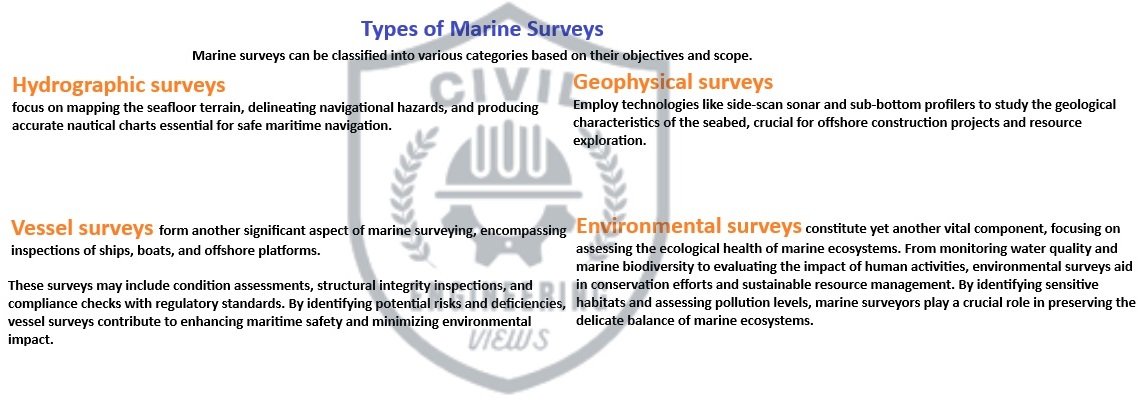
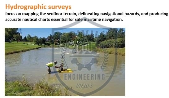
Hydrographic surveys focus on mapping the seafloor terrain, delineating navigational hazards, and producing accurate nautical charts essential for safe maritime navigation.
Geophysical surveys employ technologies like side-scan sonar and sub-bottom profilers to study the geological characteristics of the seabed, crucial for offshore construction projects and resource exploration.

Vessel surveys form another significant aspect of marine surveying, encompassing inspections of ships, boats, and offshore platforms.
These surveys may include condition assessments, structural integrity inspections, and compliance checks with regulatory standards. By identifying potential risks and deficiencies, vessel surveys contribute to enhancing maritime safety and minimizing environmental impact.

Environmental surveys constitute yet another vital component, focusing on assessing the ecological health of marine ecosystems. From monitoring water quality and marine biodiversity to evaluating the impact of human activities, environmental surveys aid in conservation efforts and sustainable resource management. By identifying sensitive habitats and assessing pollution levels, marine surveyors play a crucial role in preserving the delicate balance of marine ecosystems.

Methodologies and Technologies
Marine surveyors utilize a diverse array of methodologies and technologies to conduct their assessments with precision and efficiency. Traditional techniques such as echo sounding, conducted using single-beam or multibeam sonar systems, remain fundamental for hydrographic surveys, providing accurate depth measurements and seabed mapping.
Advancements in remote sensing technologies have revolutionized marine surveying, enabling the collection of vast amounts of data from aerial and satellite platforms. Synthetic Aperture Radar (SAR) and LiDAR (Light Detection and Ranging) systems offer unparalleled capabilities for coastal monitoring, shoreline mapping, and detecting changes in marine environments over time.
Furthermore, the integration of autonomous underwater vehicles (AUVs) and remotely operated vehicles (ROVs) has expanded the scope of marine surveys, allowing access to inaccessible or hazardous areas. Equipped with high-resolution imaging systems and sensors, these robotic platforms can perform detailed inspections of underwater structures and pipelines, enhancing efficiency and safety.

Challenges and Future Directions
Despite its importance, marine surveying presents several challenges, including the vastness of marine environments, harsh operating conditions, and technological limitations. Limited access to remote areas, unpredictable weather patterns, and the presence of natural hazards can impede survey efforts, requiring innovative solutions and adaptive strategies.
Looking ahead, the future of marine surveying is poised for exciting developments driven by advancements in technology and interdisciplinary collaboration. Emerging technologies such as artificial intelligence (AI), machine learning, and big data analytics hold immense potential for automating survey processes, analyzing complex datasets, and enhancing decision-making capabilities.
Moreover, there is a growing emphasis on integrating sustainability principles into marine surveying practices, promoting eco-friendly methodologies and minimizing environmental impact. By embracing innovation and fostering a holistic approach, marine surveying will continue to evolve as a cornerstone of maritime operations, safeguarding our oceans for future generations.
In the dynamic realm of maritime activities, marine surveying stands as a beacon of safety, sustainability, and innovation. From charting the unexplored depths to safeguarding marine ecosystems, the contributions of marine surveyors are indispensable to the maritime industry. By harnessing cutting-edge technologies, fostering interdisciplinary collaboration, and embracing sustainability principles, marine surveying will continue to navigate the challenges and opportunities of our ever-changing ocean scape. As guardians of the seas, marine surveyors play a vital role in ensuring safe passage, protecting precious marine resources, and charting a course towards a sustainable maritime future.
Related Post
-
Connect the R-8 and the R-10 through Bluetooth
-
What Is The REM And Where To Use REM
-
How To Start The RTK With Trimble Access All Steps